


【EU Stock】Autel Robotics EVO Lite 640T Enterprise Thermal Drone

- Overview
- SPECS
- Package List
- Download
-
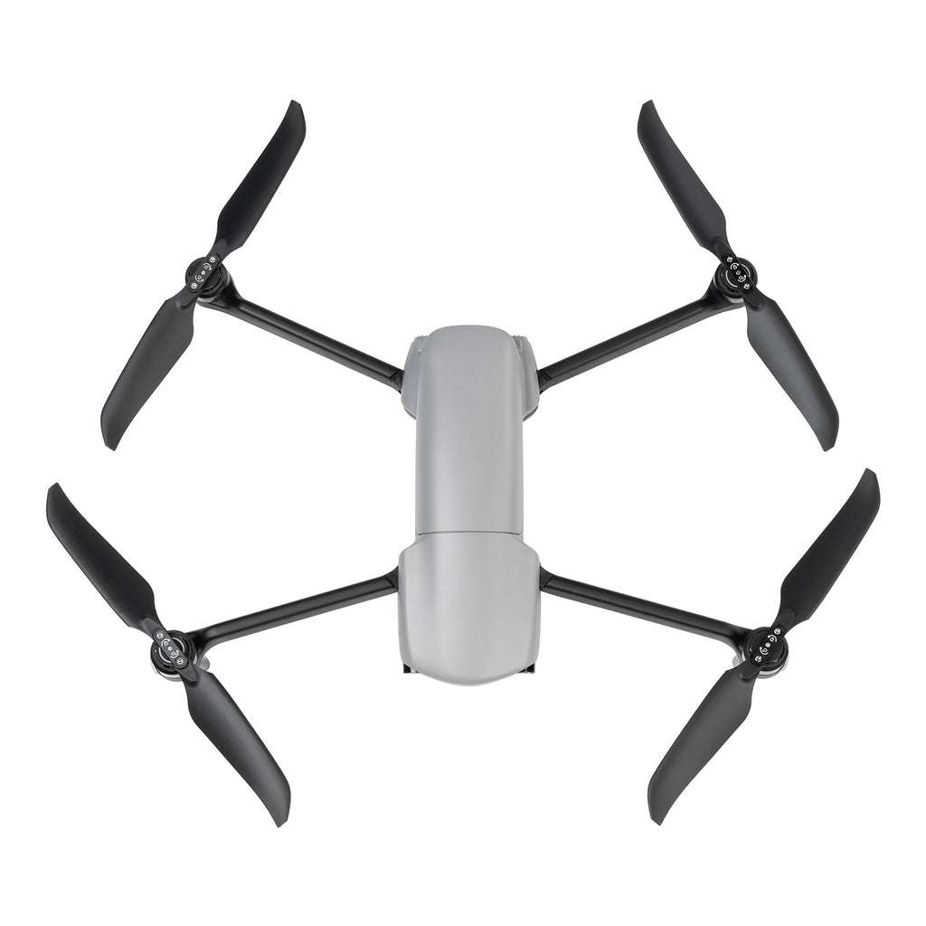
Autel Robotics EVO Lite 640T Enterprise
The EVO Lite Enterprise Series, by Autel Robotics, offers multiple advantages such as a lightweight and portable design, rapid deployment, and simple control for industrial applications. The AI target recognition feature enables the aircraft to easily identify and map various target objects automatically. The three-way binocular vision obstacle avoidance provides a safe flying experience.
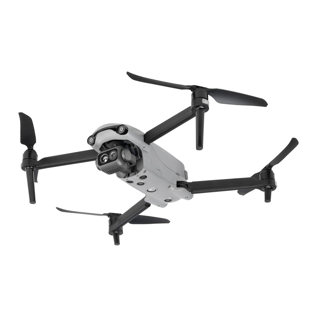
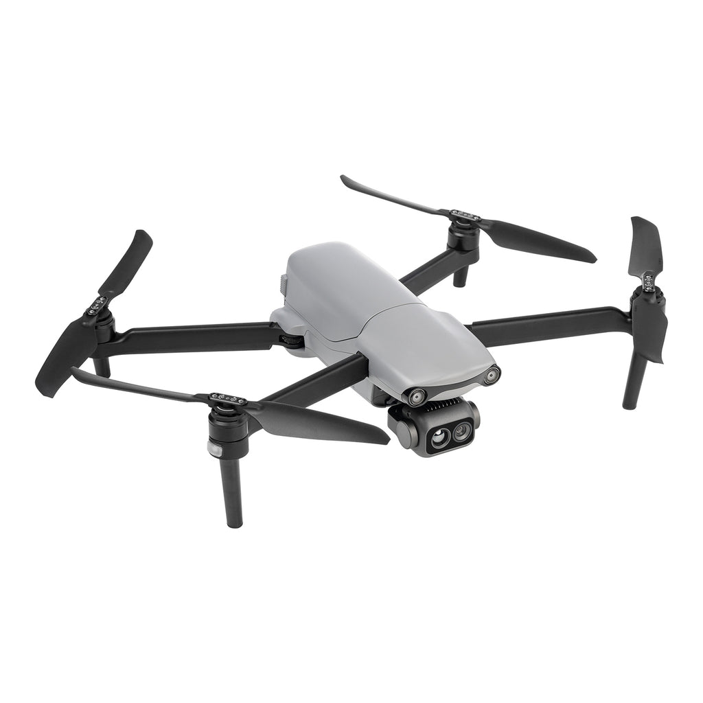
The EVO Lite 640T Enterprise features a dual gimbal system, with a visible-light camera providing clear and detailed images, while the thermal-imaging camera aids in decision-making during operations. Paired with the Autel Enterprise professional flight software, it offers easy operation, user-friendly interaction, flexible single-person deployment, and efficient application in scenarios such as public safety and emergency rescue.
Main Features
- Lightweight and Portable
- 640*512 Infrared Thermal Imaging
- 6K Resolution
- 12km Video Transmission Range
- 40-Minute Flight Endurance
- Three-Way Binocular Vision Obstacle Avoidance
- AI Target Recognition and Positioning
- Simple Control With Smart Controller SE V2

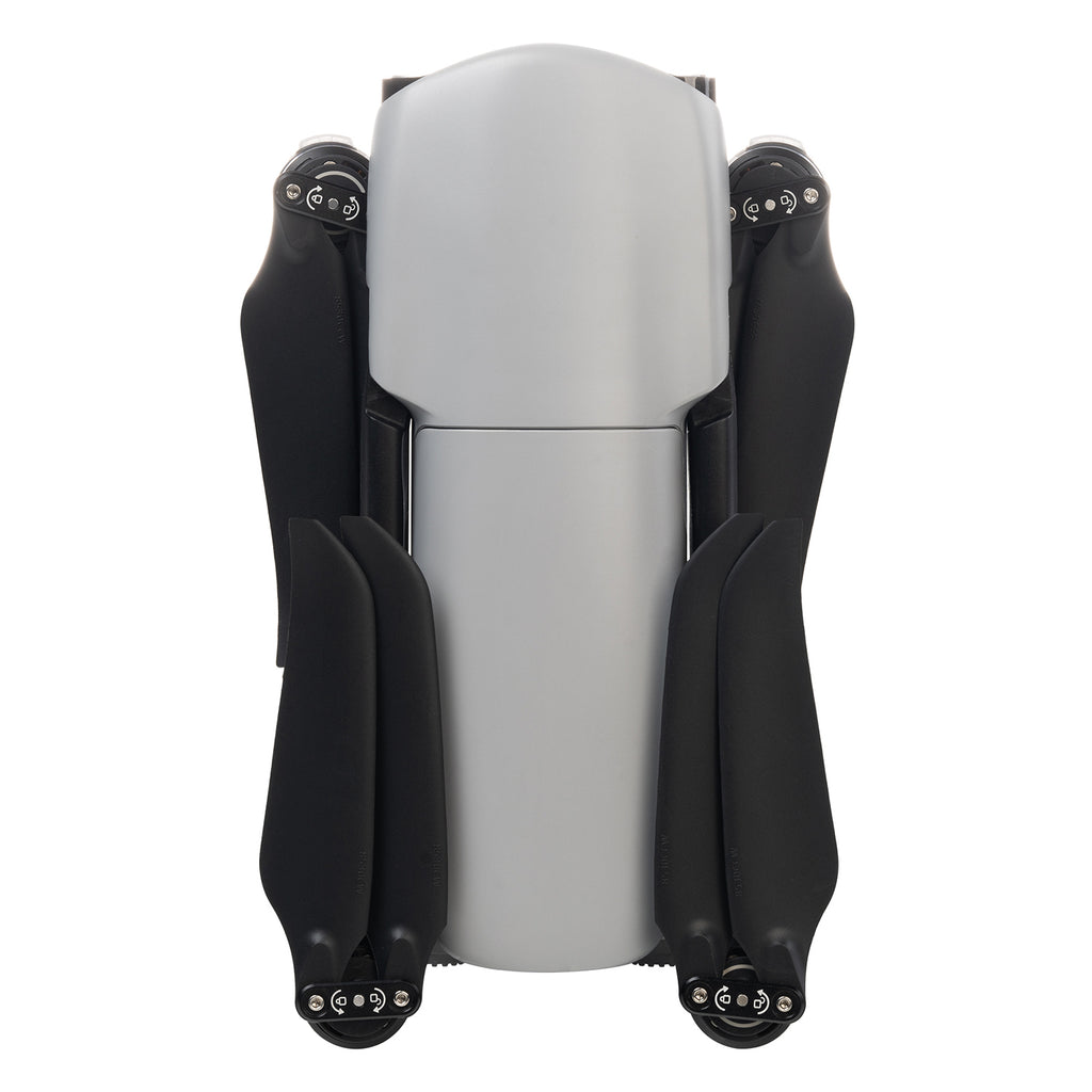
Lightweight and Portable
The EVO Lite Enterprise Series aircraft weigh only 866 grams and have folded dimensions of just 210*123*95mm, making them easy to carry in a backpack. With a simple operation, they are ideal for efficient execution of missions by a single operator.

Autel Enterprise App
Autel Enterprise is a professional flight mission software designed for industry applications by Autel Robotics. It features an optimized interaction design for simple and efficient operation, an editable toolbar design for intuitive use, and integrates intelligent and professional functions to fully utilize the industry value of the EVO Lite Enterprise Series aircraft.

Split-Screen Display: Visible light, infrared, or map support dual-channel simultaneous output on the screen, providing comprehensive information through comparison.

Customizable Toolbar: Customize the menu toolbar in the app for quick access to frequently used functions, meeting personalized usage needs.

Offline Maps: Addresses the issue of map loading failures in no-network or weak-network environments by supporting offline maps, aiding in precise flight positioning.

AI Target Recognition and Positioning
Utilizing wide-angle or infrared lenses combined with intelligent AI algorithms and a self-learning system, the aircraft can automatically recognize and locate, including people, cars, and boats, projecting their positions on the map.

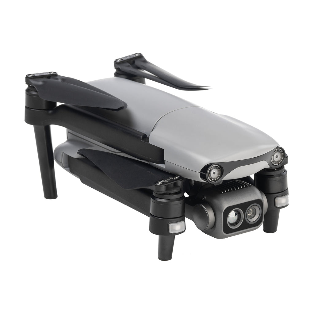
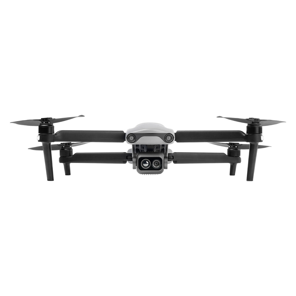
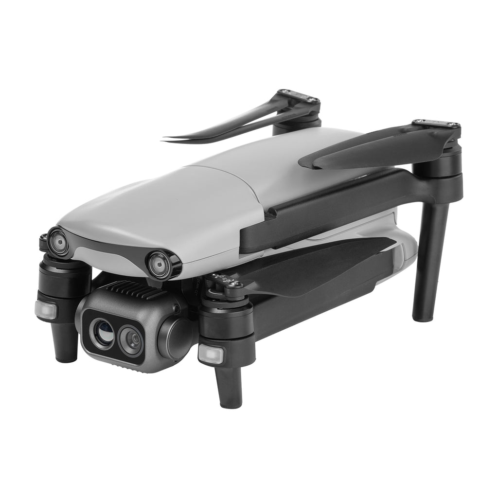
EVO Lite 640T Enterprise Dual Gimbal
Equipped with a dual gimbal, the wide-angle visible-light camera offers a broad field of view with vivid high-definition images, while the infrared thermal-imaging camera integrates high-resolution thermal-imaging algorithms, providing clear and detailed thermal source identification.

Thermal Imaging Camera
640*512 resolution // 9.1 mm focal length // 16x digital zoom
Temperature measurement range: -20°C to 150°C / 0°C to 550°C
Temperature accuracy: ±3°C or ±3% of reading (whichever is greater)
Visible Light Camera
1/2 inch CMOS // 48 million pixels // F2.8 aperture // 16x digital zoom
Maximum photo size of 8000*6000
Maximum video resolution of 4K 30P
High-Definition Video Transmission
Equipped with Autel SkyLink image transmission technology for a dual-signal, dual-reception system, the image transmission anti-interference capability improved, and the transmission distance reaches up to 12 kilometers. It supports 2.4GHz/5.2GHz/5.8GHz adaptive frequency hopping transmission, automatically selecting the best channel based on electromagnetic interference, providing strong anti-interference capability.And 1080P/30FPS real time image transmission quality.Less 200 Milliseconds latency.

Visual Perception System
The drone is equipped with wide-angle vision sensors at the front, back, and bottom, ensuring reliable flight safety.

Flight Performance
Born small but mighty. The outstanding flight performance of the EVO Lite Enterprise Series drones effortlessly tackles various challenges across multiple scenarios, significantly enhancing the efficiency of single-person mission flights.
40 minutes of endurance
18 meters per second Maximum horizontal flight speed
3000 meters Maximum takeoff altitude

SDK Ecosystem
The open Mobile SDK provides efficient, versatile, and easy-to-use control and service interfaces, enhancing development efficiency and enabling the creation of custom solution scenarios.
Data Security with Multiple Protections
Privacy Protection: Flight logs, locations, and other user privacy data require user consent to upload.
Encrypted Storage: Supports AES encryption for photos, videos, and flight logs, requiring a password for access.
Video Live Streaming: Supports RTMP and GB28181* protocols for live streaming, allowing for remote real-time viewing and analysis. *The GB28181 video live streaming protocol feature is pending future updates.
-
EVO Lite 640T Enterprise Specs
-
Aircraft
Weight 866 g Maximum takeoff weight 866 g Dimensions
210×123×95mm (folded, propellers included)
433×516×95mm (unfolded, propellers included)Max. rotation speed 8000 rpm Wheelbase 368 mm Propeller Dimension 8.5 inch injection molded propeller. Spec: 8530 Propeller weight 7.5 g Maximum ascent speed
Slow:3 m/s
Smooth:3 m/s
Standard: 5 m/s
Ludicrous: 6 m/s
Maximum descent speed
Slow:3 m/s
Smooth:2 m/s
Standard: 3 m/s
Ludicrous: 4 m/s
Maximum horizontal flight speed
(no wind near sea level)Slow :3 m/s
Smooth:5 m/s
Standard: 10 m/s
Ludicrous: 18 m/s
Maximum Service Ceiling Above Sea Level
3000 meters
Maximum flight altitude
Chinese Mainland or EU: no more than 120 meters
US: no more than 400 feet
Note:
In the flight application UAV, it can be set from 0 to 800 meters. To set beyond height required by law, you need to obtain authorization from authority.
Maximum flight time
(no wind)40 minutes
Note: Tested in lab with nearly no wind when aircraft flies at speed of 10 m/s and only for reference.Maximum flight mileage
24 km
Maximum hover time
(no wind)
37 minutes
Note: Tested in lab with nearly no wind when aircraft hovers and only for reference.Maximum wind resistance level
Fresh breeze
Maximum tilt angle
Slow: 15°
Smooth: 30°
Standard: 30°
Ludicrous: 33°
Maximum rotation angular speed
Smooth: 60°/s
Standard: 120°/s
Ludicrous: 200°/s
Working temperature
-10℃~40℃
Battery hot replacement
Not support
Internal storage
Onboard storage: 4GB (support microSD card of up to 256GB)
GNSS
GPS/BDS/GLONASS Hover accuracy
Vertically:
±0.1 meters (when visual positioning is working normally)
±0.3 meters (when GNSS is working normally)
Horizontally:
±0.15 meters (when visual positioning is working normally)
±0.3 meters (when GNSS is working normally)
-
Image Transmission
Operating Frequency 2.4G: 2.400 – 2.476 GHz*; 2.400 – 2.4835 GHz
5.2G: 5.15 - 5.25 GHz**
5.8G: 5.725 - 5.829 GHz*, 5.725 - 5.850GHz
*Only applicable to SRRC regions
**Only applicable to FCC regions
Note: Some frequencies are only available in some regions and some frequencies are only allowed for indoor use. Check local laws and regulations for details.Maximum signal effective distance
(No interference, no obstruction)FCC: 12 km
CE: 6 kmEffective transmitter power
( EIRP)
2.4G: ≤30dBm (FCC/ISED/RCM); ≤20dBm(CE/SRRC/UKCA)
5.2G: ≤30dBm (FCC)
5.8G: ≤30dBm(FCC/SRRC/ISED/RCM); ≤14dBm(CE/UKCA)
-
Visual Perception System
Sensing range Forward: 0.2~23 meters
Effective obstacle avoidance speed: <10m/s
Backward: 0.2~30 meters
Effective obstacle avoidance speed: <10m/s
Downward: 0.2~20 metersFOV Forward:
75° horizontally, 87° vertically
Backward:
35° horizontally, 45° vertically
Downward:
99° horizontally, 83° verticallyEffective use of the environment Front, rear: The surface has rich texture and sufficient lighting conditions (>15 lux, normal indoor fluorescent lighting environment)
Below: The ground is richly textured and the lighting conditions are sufficient (>15 lux, normal indoor fluorescent lighting environment) The surface is made of diffuse reflective material and the reflectivity is >20% (such as walls, trees, people, etc.)
-
EVO Lite 640T Enterprise —— Visible Light Camera
Image sensor 1/2 inch CMOS, 48 million pixels Lens
DFOV: 83.4°
Equivalent focal length of 35mm: 24 mm
Aperture: f/2.8
Focus distance: 0.5 meter ~ ∞
Focus: FF (Fixed Focus)
ISO range
Auto/Manual: ISO100 ~ ISO6400 Shutter speed
1/10000 ~1/60 seconds Defog mode
Support
Zoom
1-16x digital zoom
Maximum photo size
4000×3000, 8000×6000
Photo format
JPG
Video resolution
4000×3000 P30
Video format MP4/MOV
Video coding format
H.265/H.264
Support file system
FAT32/exFAT
-
EVO Lite 640T Enterprise —— Thermal Imaging Camera
Image Sensor Uncooled VOx Microbolometer Lens
FOV: 61°
Focal length: 9.1 mm
Aperture: f/1.0
Focusing distance: 2.2 m ~ ∞
Sensitivity
≤50mK@f/1.0, 25°C
Pixel Pitch
12um
Wavelength
8 - 14um
Radiometric Measurement Method
Center measurement/Pot measurement/Rectangular measurement
Radiometric Temperature Range
-20°C to 150°C (high gain mode); 0 to 550°C (low gain mode)
Radiometric Measurement Accuracy
±3°C or reading ±3% (using the larger value) @ ambient temperature ranges from -20°C to 60°C
Accurate Temperature
Measurement Distance
1 ~ 25 m
Digital Zoom
1-16x digital zoom
Temperature Alert
In area temperature measurement, support high and low temperature alarm thresholds, reporting coordinates and temperature values
Palette
White Hot/Black Hot/Searing/ Rainbow/Grey/Ironbow/Cold and Hot
Photo Size
640×512
Photo Format
JPG (the images contain temperature information and are parsed by dedicated SDK and PC tools)
Video Resolution
640×512 30P
Video Format
MP4/MOV
-
EVO Lite 640T Enterprise Gimbal
Mechanical scope Pitch: -135°~45°
Roll: -50°~50°
Yaw: -90°~90°Controllable rotation range
Pitch: -90°~30°
Stable system
Three-axis stabilization
Maximum control speed (pitch)
100°/s
Angualr vibration range
±0.003°
-
Autel Smart Controller SE V2
Material PC+ABS Dimensions
226.3×137.7×31.5 mm (antennas folded)
226.3×215.4×31.5 mm (antennas unfolded)
Weight 607 g Operating Temperature
-10°C to 40°C
Storage Temperature
+15°C ~ +25°C (within a year)
0°C ~ +30°C (within three months)
-20°C ~ +45°C (within a month)
Protection Rating IP43 Internal Storage
Built-in storage of 32GB
Available storage: 24GBMicroSD Extension
Supported
Operating System Based on Android 6.0.1 Application Installation
Supports the installation of third-party Android apps
USB -C Charging: supports PD/QC fast charging, up to 65W USB -A
USB2.0
GNSS GPS/Galileo/BDS/GLONASS Wi-Fi Protocol
802.11a/b/g/n/ac
Supports 2×2 MIMO Wi-Fi
Wi-Fi Operating Frequency 2.4G:
2.400 – 2.476GHz*, 2.400 – 2.4835GHz
5.8G:
5.725 - 5.829GHz*, 5.725 - 5.850GHz
*Only applicable to SRRC regions
Note: Some frequencies are only available in some regions or only used in door. For details, please refer to local law and regulations.Wi-Fi Effective Isotropic
Radiated Power (EIRP)2.4G:
≤30dBm (FCC/ISED); ≤20dBm (CE/SRRC); ≤12.14dBm (MIC)
5.8G:
≤30dBm (FCC/SRRC/ISED); ≤14dBm (CE)
Bluetooth Bluetooth 4.2 Bluetooth Operating Frequency 2.400-2.4835GHz
Note: Some regions specify frequency ranges. For details, please refer to local laws and regulations.Bluetooth Effective Isotropic
Radiated Power (EIRP)≤20dBm -
Autel Smart Controller SE V2 Image Transmission
Antenna Dual antennas, 1T2R, detachable design Operating Frequency
900M: 902 - 928MHz*
2.4G: 2.400 – 2.476GHz**,2.400 – 2.4835GHz
5.2G: 5150-5250MHz***
5.8G: 5.725 - 5.829GHz**,5.725 - 5.850GHz
*Only applicable to FCC and ISED regions
**Only applicable to SRRC regions
***Only applicable to FCC and RCM regions
Note: Some frequencies are only available in some regions or only used in door. For details, please refer to local law and regulations.Effective Isotropic Radiated Power
(EIRP)
900M:
≤30dBm (FCC/ISED)
2.4G:
≤30dBm (FCC/ISED/RCM); ≤20dBm(CE/SRRC)
5.2G:
≤30dBm (FCC/RCM)
5.8G:
≤30dBm (FCC/SRRC/ISED/RCM); ≤14dBm(CE)Maximum Transmission Distance
(Without Interference and Blocking)
FCC: 12 km
CE/SRRC: 8 km
-
Autel Smart Controller SE V2 Display
Resolution 1440×720 Refresh Rate
60Hz
Touch Control
Supports 10-point touch
-
Autel Smart Controller SE V2 Battery
Battery Type Li-Po Rated Capacity
1900 mAh
Voltage
DC 7.7V
Battery Energy
14.63 Wh
Charging Time
About 90 minutes
(charging time is related to actual remaining power)Battery Endurance
1.5 hours (Max brightness)
2.5 hours (50% brightness)
Battery Replacement
Supported
-
Smart battery
Operating Temperature 0 ~ +40℃ Battery Type
LiPo 3S
Rated Capacity
6175 mAh
Battery Energy
68.7 Wh
Voltage
11.13 V
Charging Voltage Limit
12.75V
Rated Charging Power
63.75W
Rated Charging Power
78W
Weight
309g
Battery charging temperature
+5-+45℃
(When the battery temperature is below 5℃, the battery stops charging. When the battery temperature is above +45℃, the battery stops charging.)
Ideal storage environment + 22℃ ~ +28℃ Storage temperature and humidity - 10℃ ~ +30℃, 65 ± 20%RH -
Battery Charger
power input 100-240V ~ 50/60 Hz, 1.5 A Output port
Battery charging interface/USB-A
Battery charging interface
12.75V⎓5A
USB charging port
5V⎓3A, 9V⎓2A, 12V⎓1.5A
Rated power
63.75W Max
-
-
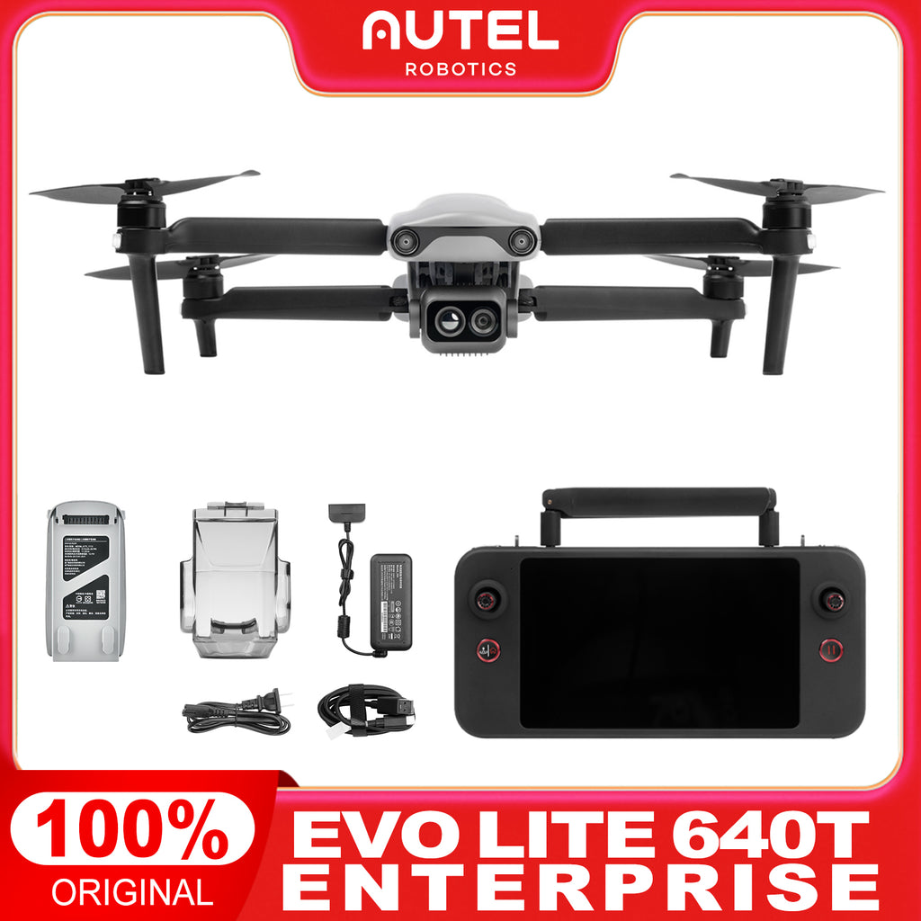
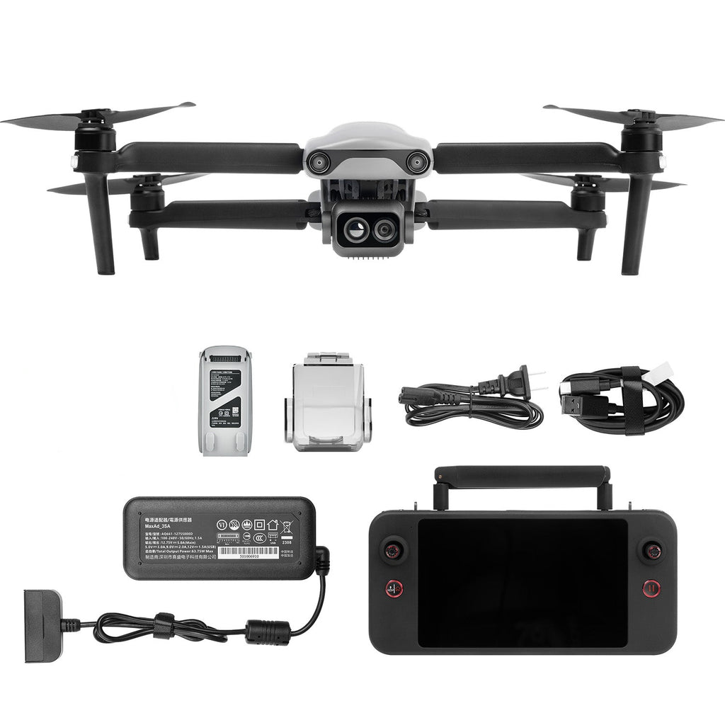
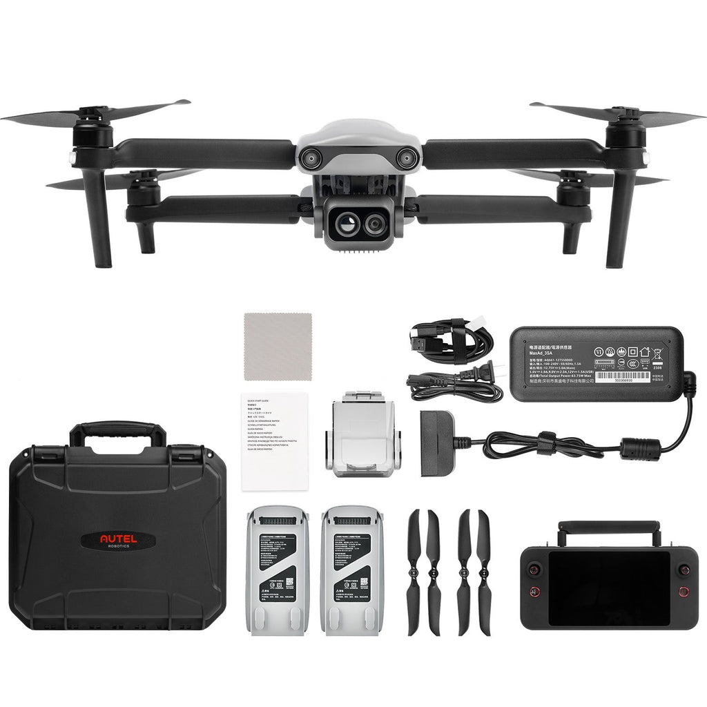
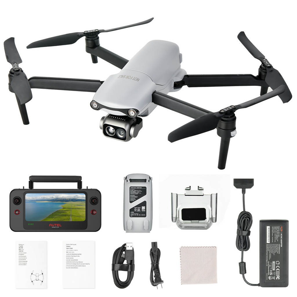
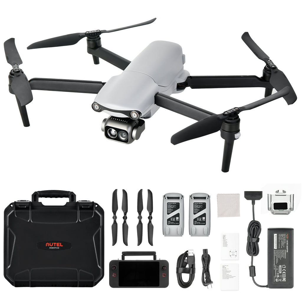
What's In The Box?
Standard Bundle
Aircraft*1
Remote controller*1
Battery charger*1
USB-C to USB-A Data cable
User Documentation
Premium Bundle
Aircraft*1
Remote controller*1
Battery charger*1
USB-C to USB-A Data cable
User Documentation
Rugged case*1
Spare Battery*2
Spare Propeller*2 Pair
-
EVO Lite Enterprise Series User Manual